HIGHWAYS HERITAGE WALKS
Walk the Magna Via – in Halifax
Walk Length: 2 ¼ mls, 4 mls, 6 mls options
Grade: Magna Via route is medium, on steep cobbled tracks, paths and roads, caution needed if wet underfoot. Not suitable for the mobility impaired or young children. Shibden Valley route is easy and suitable for children.
Grid Reference: SE1065625774 Postcode: HX3 6XG
Public transport: Shibden Estate is accessible by bus numbers 681, 682, 548, 549, 509, 534, 227, 508, 226 from the Halifax, Bradford, Brighouse, Huddersfield and Leeds bus stations. Rail station: Halifax.
Parking: in the car-parks of Shibden Hall (small charge),
start point is the Upper Car-park.
www.calderdale.gov.uk
Description
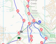
This walk forms a ‘figure of eight’ around Shibden Hall, giving various options for distance and difficulty. From the first Halifax turnpike, climb the old cobbled thoroughfare to enjoy views from Beacon Hill across Halifax and the Shibden Valley, then follow the track back to Shibden Park and a tollhouse on the second turnpike. Take a stroll up the valley through lush fields before returning to the Park. A visit to the atmospheric half-timbered house and its folk museum (with carriages) is essential.
Route Instructions
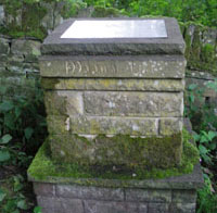
1. Ancient milestone from the first turnpike.
2. Packhorse track.
3. Steep cobbled path, the Magna Via.
4. Halifax bank.
5. Paved Way.
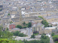
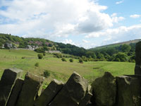
6. Extensive views over Halifax.
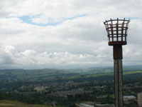
7. Beacon basket.
8. Possibly a guide stoop.
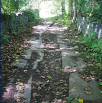
9. Medieval packhorse track.
10a. Information board.
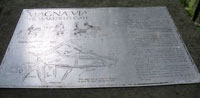
10b. Information board.
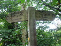
11. Sign points to Shibden Hall Road..
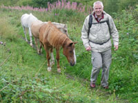
12. Ponies in field.
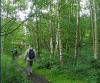
13. Birch coppice.
14. Upper Dove House
15. Denmark Farm, a traditional
Yorkshire long house.
16. Partially paved track.
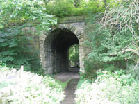
17. The railway tunnel.
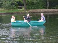
18. Boating lake.
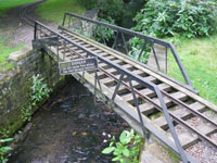
19. Bridge towards the station of
the miniature railway
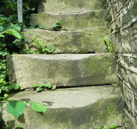
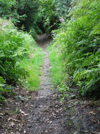
20. Worn stone steps.
21. Halifax-Bradford and the
Halifax-Leeds turnpikes.
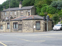
22. Well-preserved and extended toll-house.
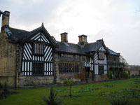
23. Shibden Hall
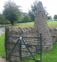
24. The National Dry Stone Walling Exhibition.
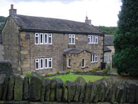
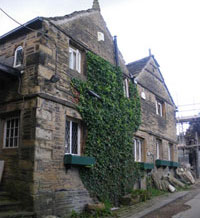
25. Staups House (No. 36) was built in 1684.
26. Staups Lane.
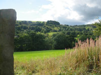
27. Views up the Shibden valley.
28. Twin tracks.
29. Open pasture.
30. Looking back.
31. The Dicken.
32. Dam Head.
33. Shibden Mill Inn.
34. Lister Bridge.
35. Single Track.
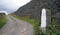
36. Dry Stone Wall.
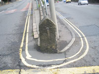
37. Stone and cast iron bollards .

38.
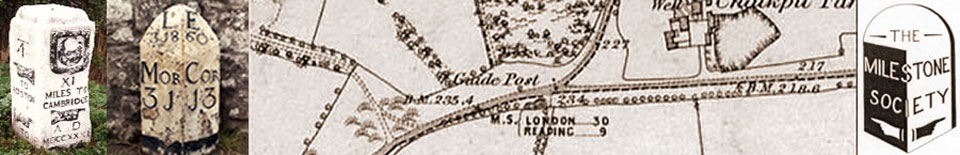
Turn right from the carpark, up the Shibden Hall Road. After 250 yards, look at the wall on the right to find an ancient milestone from the first turnpike (1741). 1 Although the stone has been moved from its original position, note that the way to Wakefield is shown to the left, “Fifteen miles and a ¼ “ along the old route over Elland. The distances are measured in long or ‘customary’ miles which existed into the C19th in the Pennines.
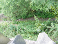
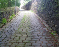
Continue over the brow of the hill , cross the road and bear left down a cobbled lane, by a metal paling fence, down Old Bank (before the bridge over the Godley cutting) to Godley Branch Road. Cross to the pavement on the opposite side and walk up Beacon Hill Road. If you look over the stone wall, 2 you can see the packhorse track winding up the hillside from the town. After 200yds, past the Aquaspersion sign, cross back over the road to the public footpath sign and take the steep cobbled path, the Magna Via. 3
Until 1741, this was the main approach to Halifax from the east, for both packhorse and foot traffic. Also known as Wakefield Gate (‘gate’ from the old Norse ‘gata’, a way), it linked with the Long Causeway to Burnley. 4 In the C18th, Daniel Defoe wrote “We quitted Halifax not without some astonishment at its situation. Halifax bank is so steep, so rugged and sometimes to so slippery that to a town of so much business as this is, ‘tis exceedingly troublesome and dangerous.” The cobbled highway winds up the side of Beacon Hill. 5 As it levels out, notice a large fallen stone, possibly one of the guide stoops erected by the Justices in accordance with the Act of 1697.
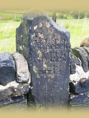
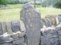
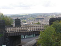
Either continue straight ahead or, for a pleasant circular diversion around the top of Beacon Hill, take the higher of the two footpaths on your right. There are extensive views over Halifax, 6 the Piece Hall, Square Chapel, the Parish Church, the old bridge below the flyover, Dean Clough and the Wainhouse Tower, with Studley Pike and the Ogden Water wind farm on the horizon. Pass the Beacon basket 7 and look for a gap at the end of the wall; turn left along the walled path. Panoramic views to Emley and the Ferrybridge power station open up. Continue through a gate and follow the path across a playing field. Turn left at Long Lane, a gravelly track, and note a white painted stone, 8 possibly a guide stoop, by a high wall at the corner of the private road to Beacon House. Rejoin the main route by a green gate, at Barrowclough Lane.
Looking back towards Shibden, you can see two small towers (ventilation shafts) in the field; one belongs to mine working and the other to the railway tunnel below. The railway was built in 1851 to link Bradford to the existing Calder Valley line. Continue along Barrowclough Lane, a cinder track; after approximately half a mile, bear left down Dark Lane, a narrow grassy track under a large pylon line, with a builder’s yard on your right.
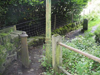
This is the continuation of the medieval packhorse track, in its original condition though overgrown, a narrow holloway paved with setts that becomes a running stream in wet weather. 9 An Act of Parliament in 1555 made local parishes or townships responsible for the upkeep of the highways and people were required to provide labour or payment in lieu, ‘the Composition’, the earliest form of rates. Follow the track until it meets a road after an information board 10 a & band bear left, to a group of houses on Norcliffe Lane. Badger Lane is the continuation of Norcliffe Lane: badgers, jaggers and panniermen were old names for the pedlars with their packhorse trains led by a horse with bells on its harness to advertise their approach. However, our walk turns immediately left over the Red Beck bridge just past the houses; the footpath sign points to Shibden Hall Road. 11
Follow the path across an open field 12 over a stone step-style and through a birch coppice, 13 bearing right following the path along a hedge. Climb the short flight of steps to the road and turn left. This is Halifax Old Road, the first turnpike, completed by ‘Blind Jack’ Metcalfe of Knaresborough in 1750. Because road travel was slow and difficult and better trade routes were needed, Turnpike Trusts were set up by Acts of Parliament from 1706 to 1840s, to repair and later to extend the highway network. Users were charged tolls to pay for this work. The name ‘turnpike’ comes from the spiked barrier at the Toll Bar. From 1767, mileposts were compulsory on all turnpikes, not only to inform travellers of direction and distances, but to help coaches keep to schedule and for charging for changes of horses at the coaching inns.
Continue along Halifax Old Road which becomes Shibden Hall Road as it crosses a bridge. Pass Dove House Nurseries on the left; Upper Dove House 14 was recorded in 1408 and was used for Shibden Industrial School from 18877 to 1932, to care for and to teach a trade to young people with problems. Denmark Farm, a traditional Yorkshire long house, on the right, has a date-stone of 1769. 15
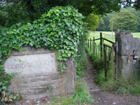
If you wish to shorten the walk, you can continue up this long straight road back to the car-park. You will find a LYR stone marker over the park wall by the footpath that drops down into Shibden Park, for the Lancs Yorks Railway, whose tunnel is still operational deep beneath your feet. There is also an old stone in the park wall behind a roadsign, with no visible inscription, possibly a boundary marker.
Otherwise turn right down a partially paved track by the right-hand side of the entrance to Rodridge Farm, 16 between fields. Through the railway tunnel, 17 the path opens into Shibden Park. Pass the playground on the left and bear right down to the boating lake. 18 The lake was created by Ann Lister and is fed by the Red Beck, so called because it is naturally polluted with iron oxides. Turn left along the lake path to the end, c 150 yds. There are a cafe and toilets to your left.
The walk follows the end of the lake to the right; cross the bridge towards the station of the miniature railway. 19 Walk round the back of the station and follow the woodland track uphill to Old Godley Lane. Climb a flight of worn stone steps 20 (or walk up the road!) to reach Stump Cross on the turnpike created between 1827 and 1830 by blasting out the Godley Cutting with gunpowder, now the A58. Turn right to see the junction of the Halifax-Bradford and the Halifax-Leeds turnpikes 21; there is a well-preserved and extended toll-house on the other side of the road. 22
You have now walked a fairly strenuous four miles; to return to the Upper Carpark, retrace your steps down to Old Godley Lane, turn left down Red Beck Road and cross the Lower Carpark, past the café and toilets, climbing the grassy embankment bearing right past the Hall to the Upper Car-park.
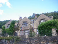
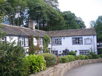
In the care of Calderdale Council, the half-timbered Hall 23 is well worth a visit; it dates from 1420 and has furniture and interior decoration from C16th onwards, with reminders of Anne Lister’s unconventional life. There is also a homely tea-room; carriages and other vehicles are housed in the folk museum outbuildings and the terrace garden has been delightfully restored in a paisley pattern.
The National Dry Stone Walling Exhibition adjacent to the Hall demonstrates the intricacies of this ancient craft; see lunky holes and a pinfold! 24
To continue the walk with a pleasant stroll in the pretty wooded Shibden Valley, cross the road, walk back past the Stump Cross Inn (rebuilt around 1830) and turn right up Staups Lane. Staups House (No. 36) was built in 1684 for Joshua Crowther and is a fine example of a 17th century local residence. 25 It was for sale at £550k or offers in August 2011, having been reduced from £800k; the owners had recently had 72 new leaded lights fitted to the mullion windows.
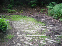
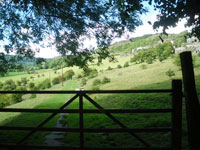
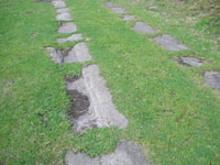
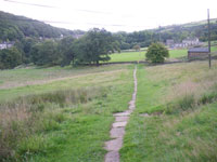
Keep to the lane alongside the wall of Staups House; the surface is now setted and steeper. 26 Stay on the lane, passing Salterlee House on your left. At the end of the setts, the lane adjoins Kell Lane. Take the footpath to your left, following the tarmac drive of No. 85 to a field gate with open views up the Shibden valley. 27 Go through the side gate and follow a straight double-paved track across fields. The two rows of stones were designed to take heavy carts carrying products of the local mines and quarries from higher up the valley down to Stump Cross – you can see the grooves worn in them. 28 Stone, fireclay and coal were extracted in this area.
When the paving ends, continue on the track, go through a gate by a gap at the left-hand side and continue straight across open pasture 29, 30 to reach a road, Blake Hill, originally called Bleak Hill Lane.
Cross the road and walk up a grassy, walled track called The Dicken for 200 yds, 31 signed to Dam Head. At the end, turn left opposite the gable end of a building and look for Dam Head (after Dam Head Cottage), originally a 1500s timber-framed aisled hall, substantially altered since and under restoration. 32 Bear left down to the road as the double paved track turns right, and continue along the footway to the Shibden Mill Inn, dating from 1643. 33 Bear right across the Inn’s carpark, or pause for refreshments and to listen to the sound of the Shibden Beck.
Join the wide, walled dirt track beyond Shibden Beck, Horley Green Lane. Follow this, enjoying views of the quiet green countryside with splashes of vivid purple heather in autumn.
Eventually the lane forks, beside a small domestic mail-box. You have a choice! If you take the right-hand fork, the continuation of Horley Green Lane, you will walk directly towards Beacon Hill. Through the garden of a brick house, the track narrows to a walled path, eventually emerging from the countryside through the houses of Claremont. Bear right and cross the Godley Cutting by the wrought-iron 1900 Lister Bridge with its ornate gas lights. 34 Follow the Shibden Hall Road back to the Upper Carpark.
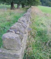
If you take the left-hand fork, you will walk in the valley bottom back to Stump Cross. Walk along the slabbed path adjacent to the wall (not the wider dirt track), drop down some stone steps and follow the paved path across two fields.35, 36 The dry stone wall between the fields is an attractive example of protruding tie-stones. Go through a small gate. The paved path at right angles to the left, along a wall, leads past pretty Field House over the beck back to Staups Lane, opposite Staups House, and you can walk down the lane to Stump Cross.
Otherwise, continue straight ahead through a slab stile, cross the paved yard of a newly restored property and follow the gravel track through a cluster of cottages called Shibden Fold Terrace. A ‘fold’ is a group of farm buildings. Bear left down a grass track along a wall. Now you can hear the roar of traffic on Godley Lane, the A58. Passing stone and cast iron bollards as the path turns left, climb up the cobbles, noting the ridges for grip. 37 Emerge onto Godley Lane, turn left towards Stump Cross and cross the road with caution. Retrace your way down the old stone steps and along Old Godley Lane, turning left into Red Beck Road to the Lower Car-park. Cross the Lower Car-park, past the café and toilets, climbing the grassy embankment bearing right past the Hall to the Upper Car-park. Don’t neglect to visit the Hall itself and the Dry Stone Walling Exhibition!
This walk has been adapted from AA “Fifty Walks in Yorkshire Dales”: www.theaa.com/walks/halifax-and-the-shibden-valley and “Walks from Shibden Park” by the Calderdale Countryside Service.
The Milestone Society, established in 2001, campaigns for conservation of milestones and waymarkers, which are endangered by neglect, by vandalism and by casual destruction, and aims to share our interest in these fascinating pieces of history.
You can find out more about our work plus details of more than 9000 milestones in the UK by visiting our website, www.MilestoneSociety.co.uk 38
While care has been taken to ensure the information above is accurate, the Milestone Society accepts no liability for any claim, loss, damage or injury (howsoever arising) incurred by those using the information provided. Please ensure that you wear suitable footwear and always carry a drink and a snack.
CLICK HERE to download a PDF to print out this walk